
High resolution flow datasets for surface runoff, surface lateral runoff and drainage pathways from 1 ha sized hydrologically isolated plots.
 (2023)
High resolution flow datasets for surface runoff, surface lateral runoff and drainage pathways from 1 ha sized hydrologically isolated plots.
[Data Collection]
(2023)
High resolution flow datasets for surface runoff, surface lateral runoff and drainage pathways from 1 ha sized hydrologically isolated plots.
[Data Collection]
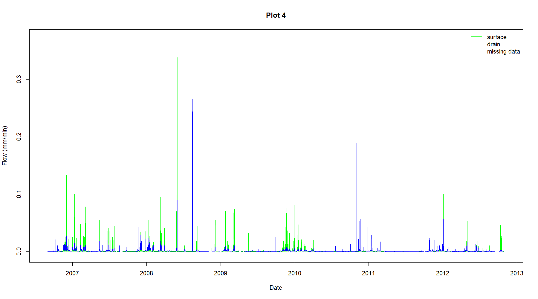
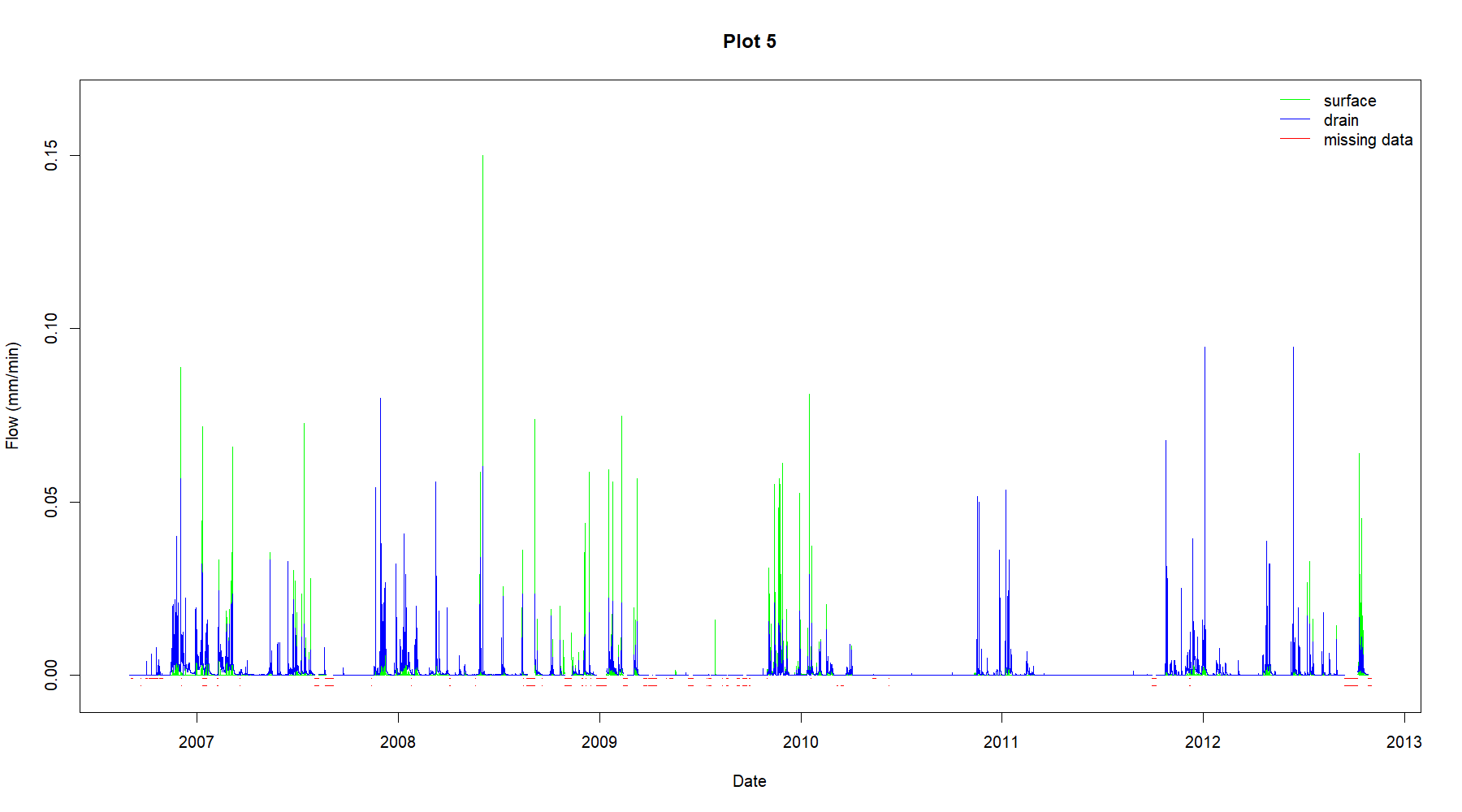
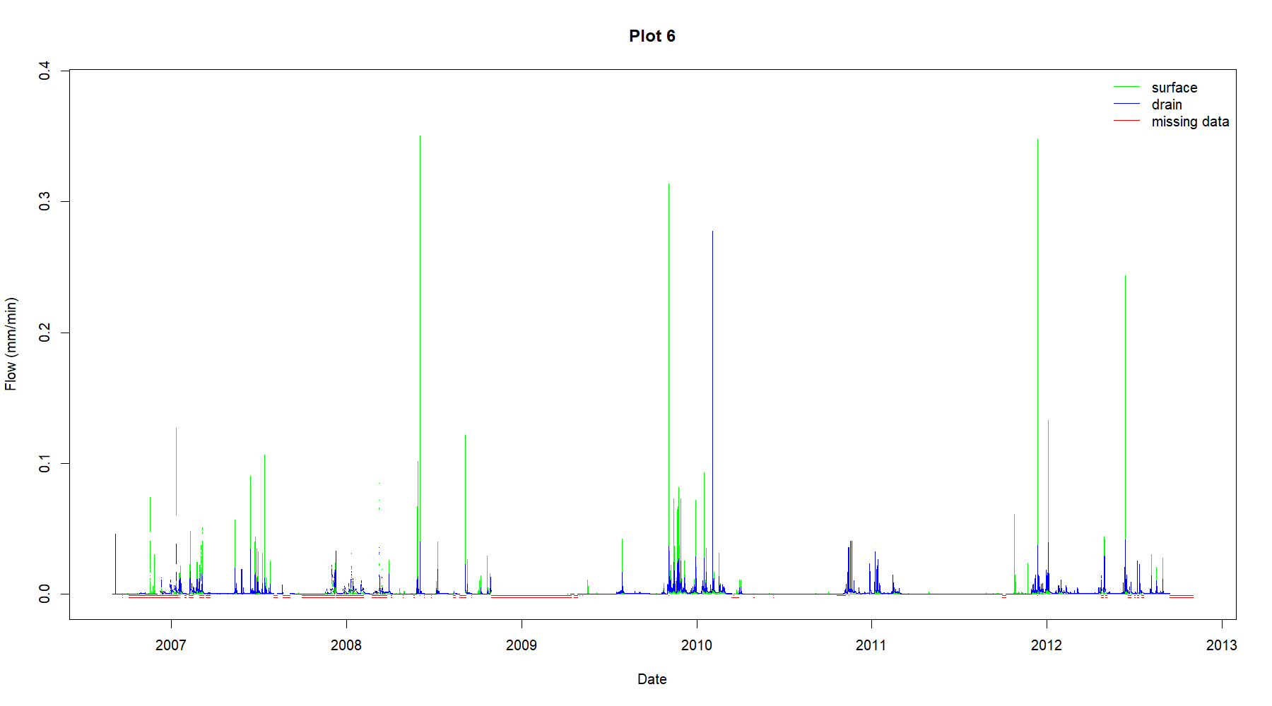
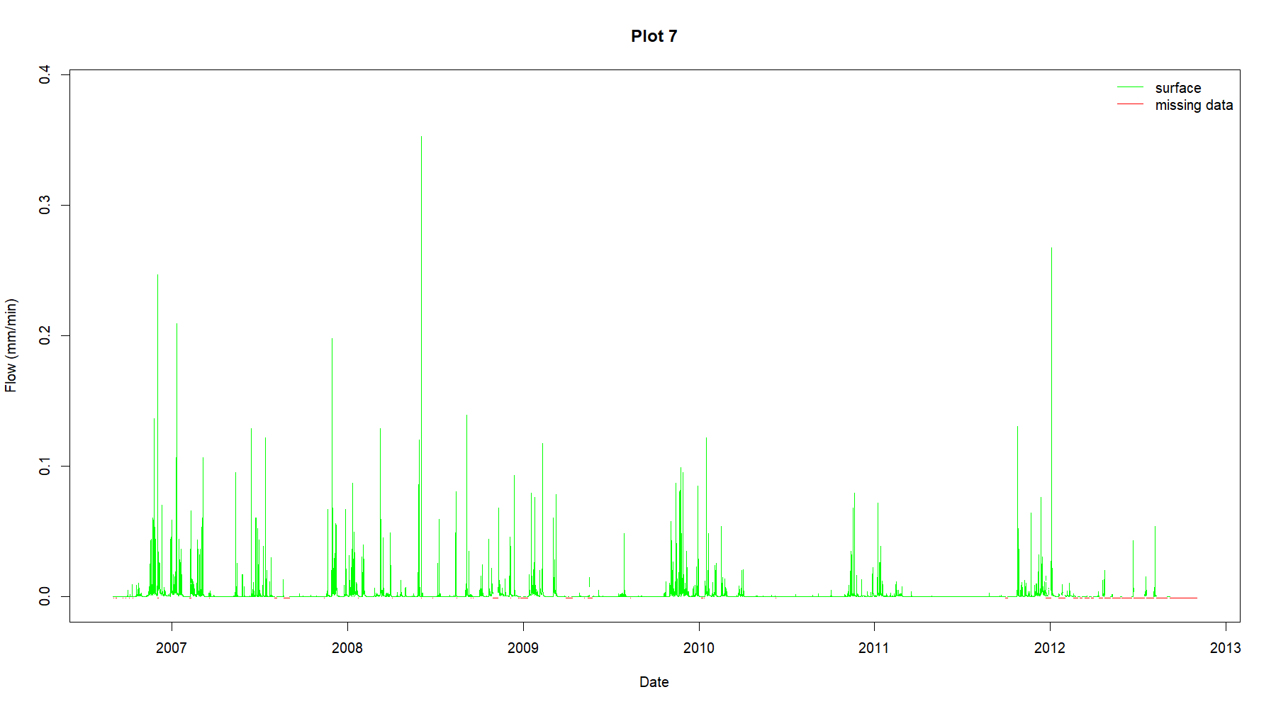
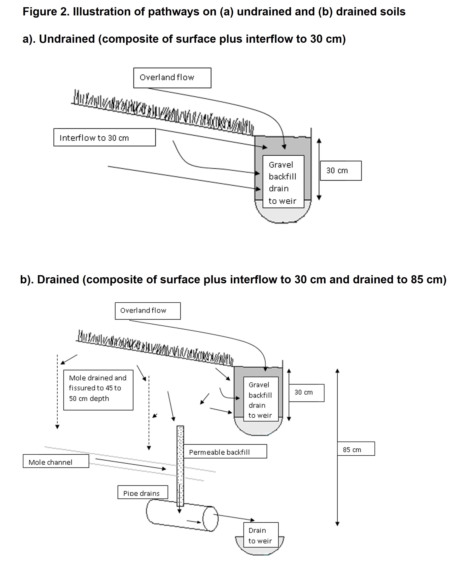
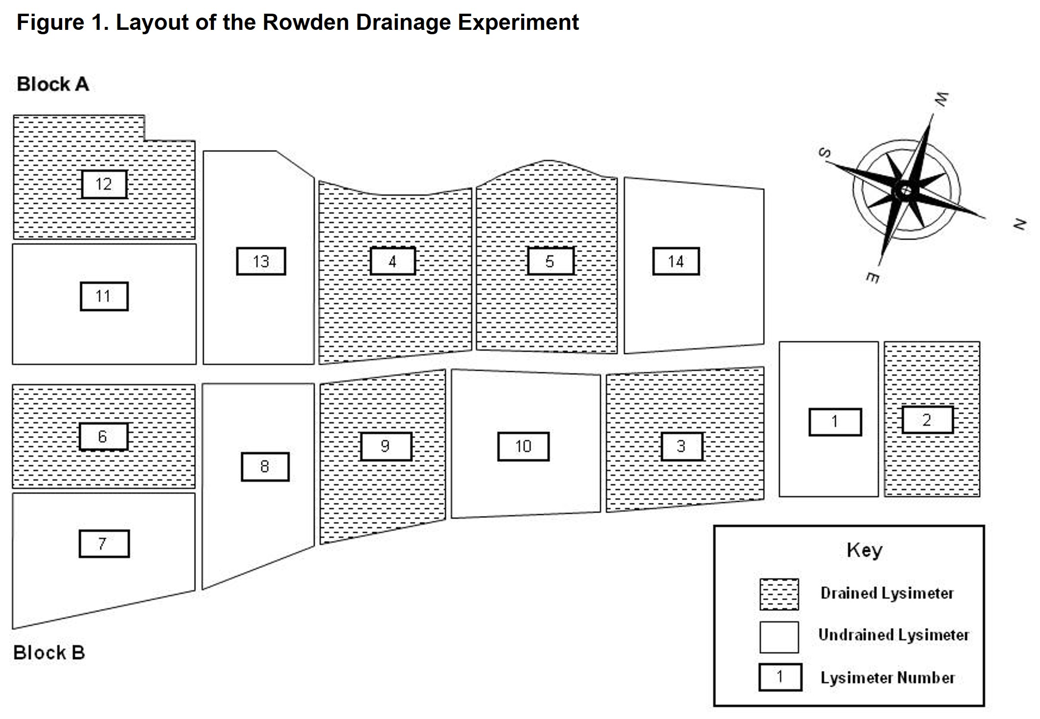
This dataset describes hydrology and rainfall data from a site known as the Rowden Drainage Experiment, which has 14 field-scale (1 ha sized) lysimeter plots. The experimental site was established in 1982 to primarily investigate the effects of land drainage and inorganic fertilizer input on herbage production, animal performance and nutrient losses from permanent and reseeded grassland overlaying impervious subsoils.
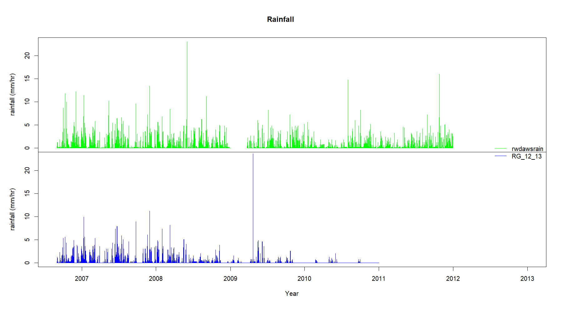
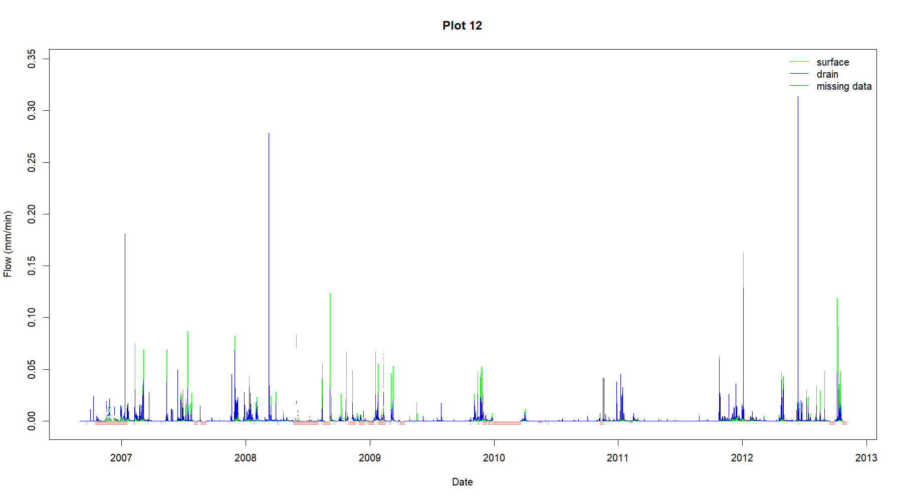
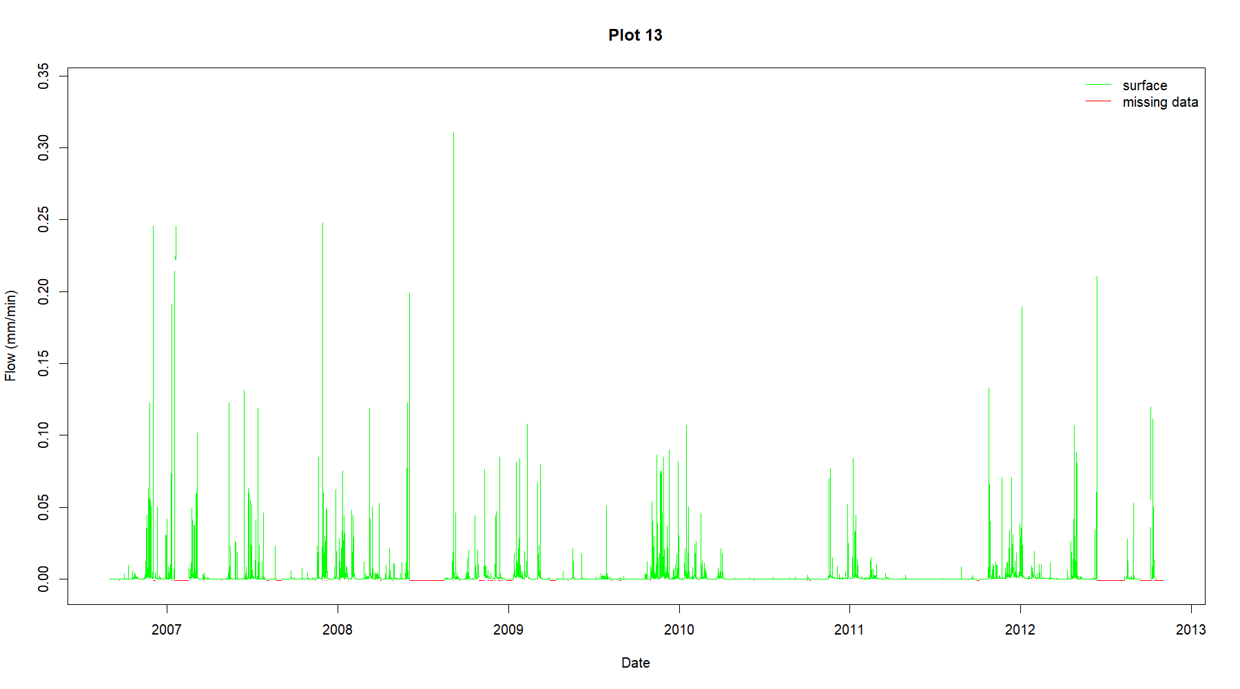
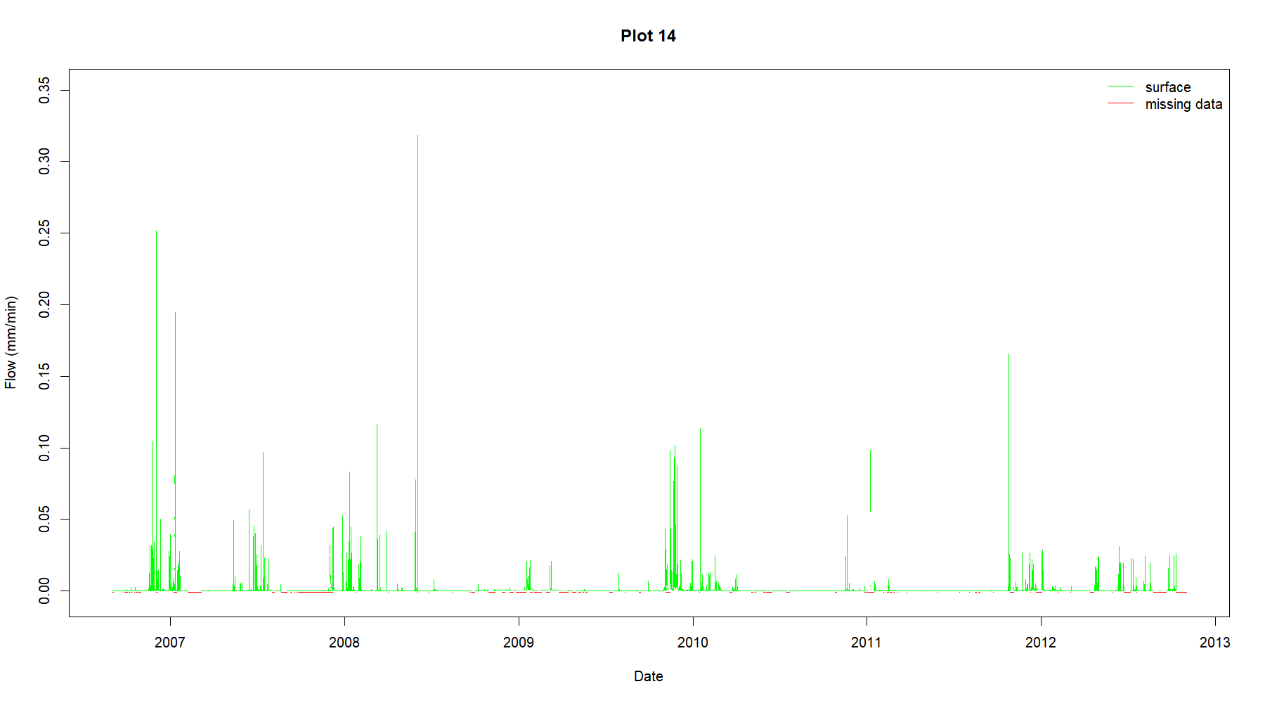
The hydrology dataset ‘RowdenHydrology.csv’ comprises hydrological discharge rates (mm / min) expressed as uncertainty envelopes (min and max uncertainty) for flow via surface/subsurface lateral and field drain pathways. The data were collected at 1-minute intervals from Sept 2006 to Oct 2012. Users should be aware that this .csv file is best opened from software such as R or python due to its size. Annual rainfall data collected at 60-minute intervals by two different instruments and spanning the period Sept 2006 - Dec 2012 are also included in ‘RowdenRain.csv’. Column units and descriptions are given in the metadata file, ‘Column_units_and_descriptors.csv’.
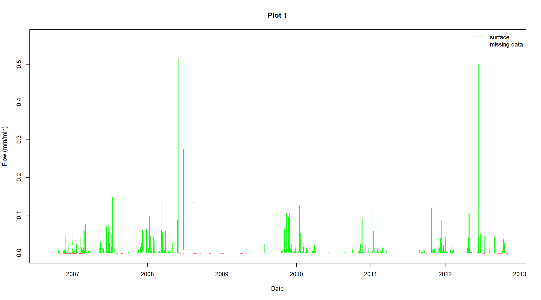
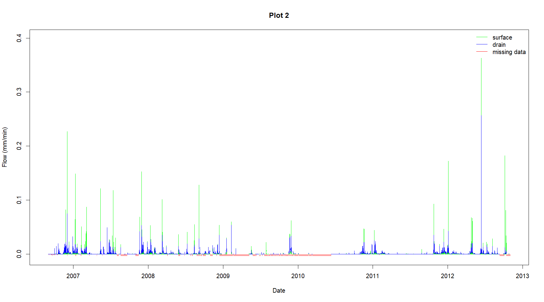
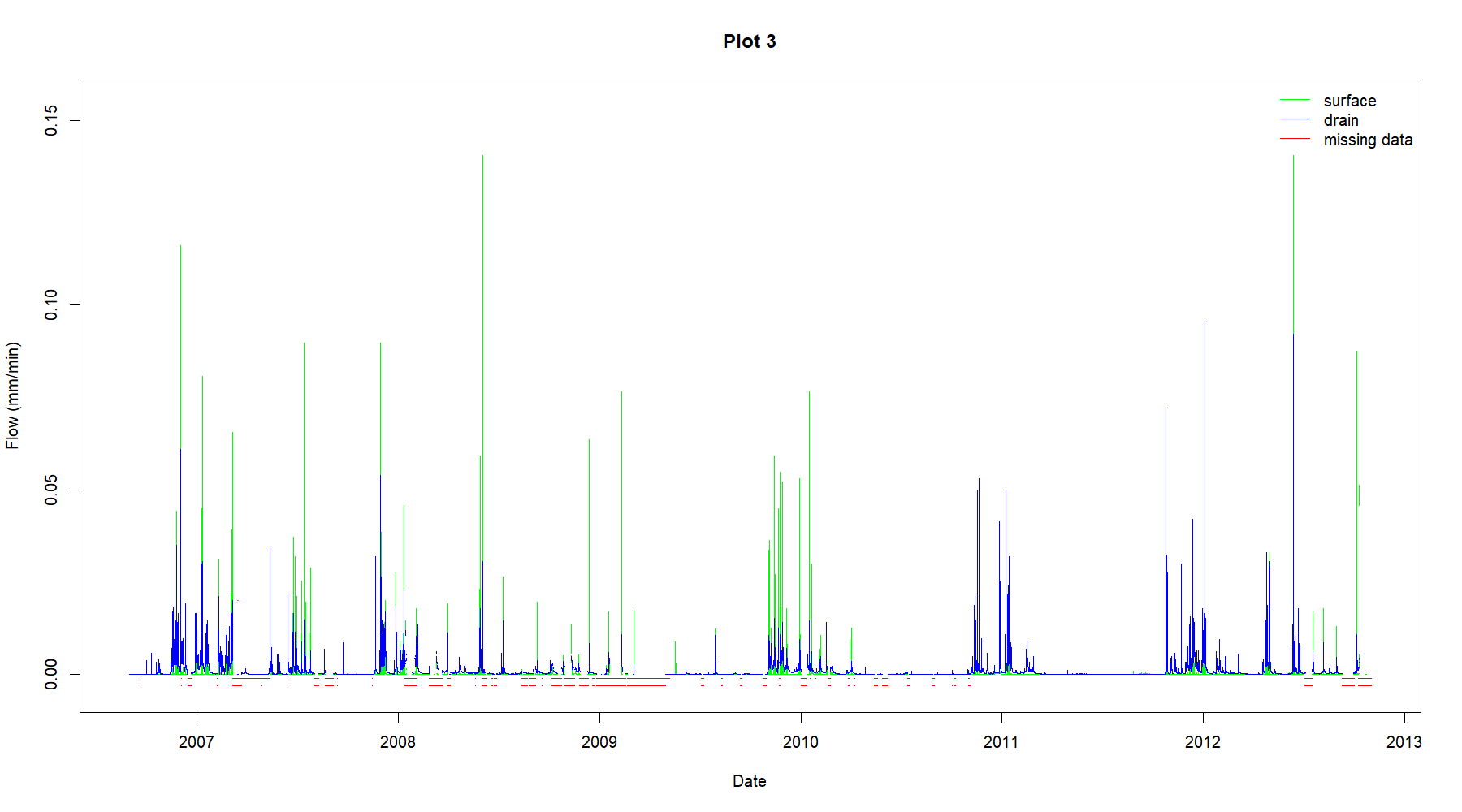
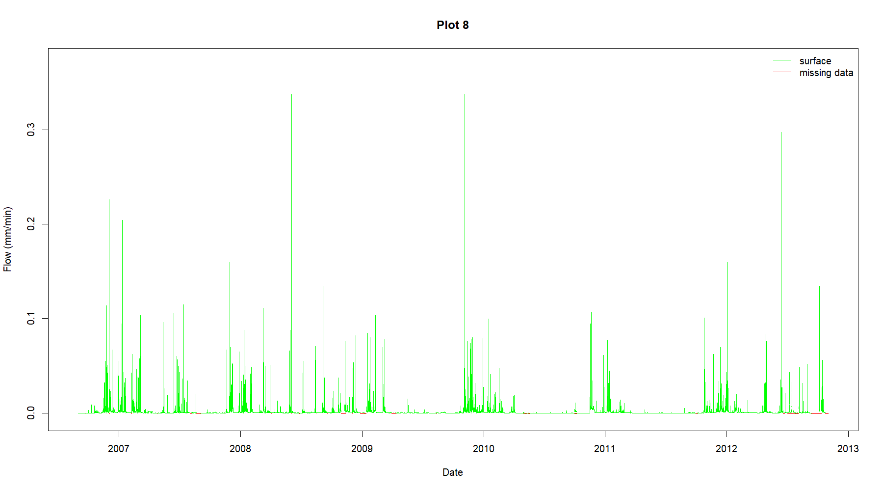
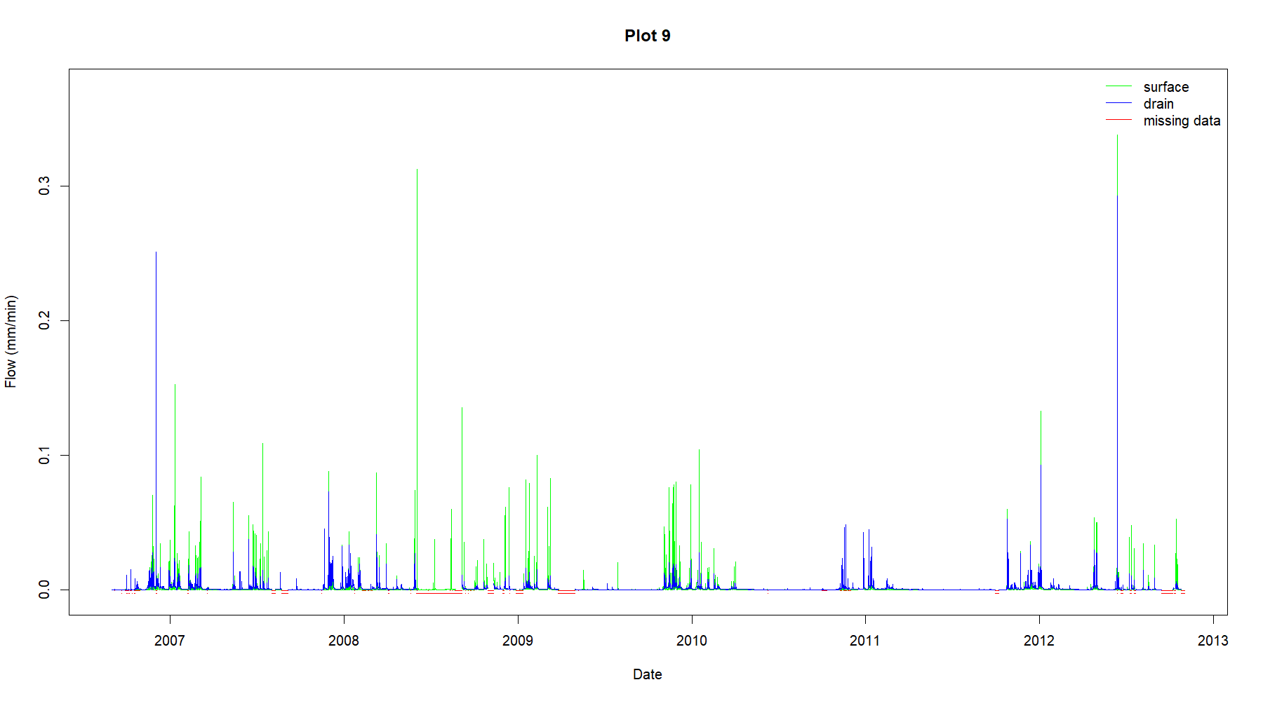
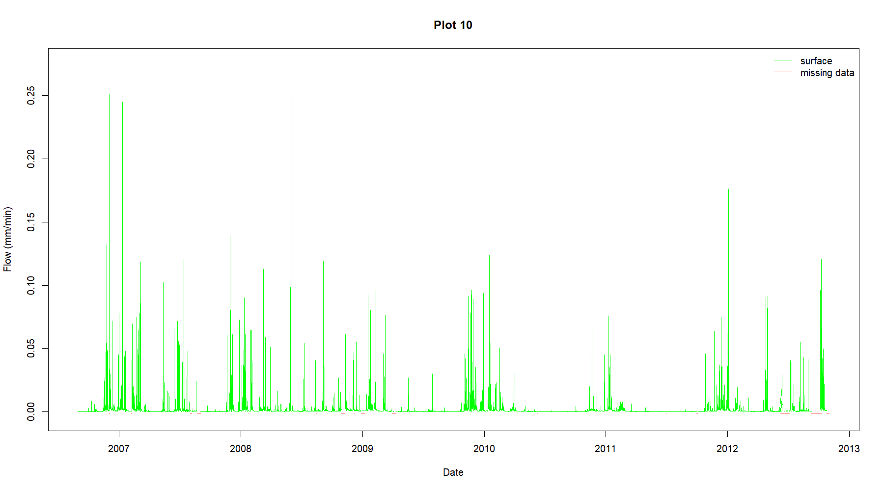
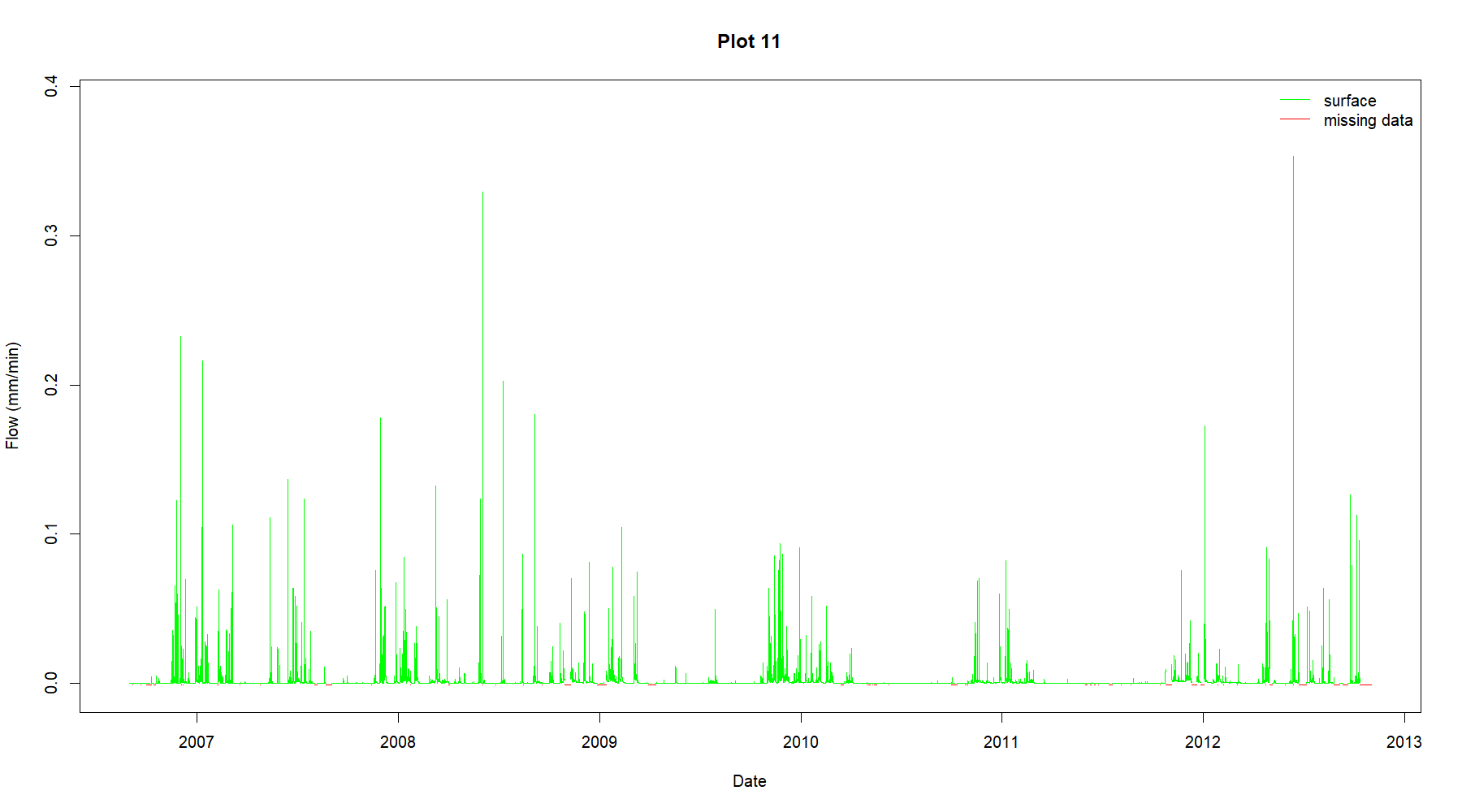
'Fig1.jpg' is a map showing the site layout of the Rowden Drainage Experiment, and 'Fig2.jpg' is an illustration of the collection pathways on the undrained and drained plots. In addition, graphs (.png files) of the mean of the uncertainty envelope values for each plot are included as a visual guide to the data and help illustrate where there are missing data. In these, red lines indicate areas of missing data. For drained plots, the top line represents quality of the surface lateral runoff data, and the bottom line the quality of the drainage data.
-
subject - Other
- Creative Commons Attribution
- Available under Creative Commons: Attribution 4.0
grid_on - text/csv
- folder_info
- 1MB
-
subject - Other
- Creative Commons Attribution
- Available under Creative Commons: Attribution 4.0
grid_on - text/csv
- folder_info
- 752MB
-
subject - Other
- Creative Commons Attribution
- Available under Creative Commons: Attribution 4.0
image - image/png
- folder_info
- 19kB
-
subject - Other
- Creative Commons Attribution
- Available under Creative Commons: Attribution 4.0
image - image/png
- folder_info
- 17kB
-
subject - Other
- Creative Commons Attribution
- Available under Creative Commons: Attribution 4.0
image - image/png
- folder_info
- 16kB
-
subject - Other
- Creative Commons Attribution
- Available under Creative Commons: Attribution 4.0
image - image/png
- folder_info
- 20kB
-
subject - Other
- Creative Commons Attribution
- Available under Creative Commons: Attribution 4.0
image - image/png
- folder_info
- 17kB
-
subject - Other
- Creative Commons Attribution
- Available under Creative Commons: Attribution 4.0
image - image/png
- folder_info
- 18kB
-
subject - Other
- Creative Commons Attribution
- Available under Creative Commons: Attribution 4.0
image - image/png
- folder_info
- 18kB
-
subject - Other
- Creative Commons Attribution
- Available under Creative Commons: Attribution 4.0
image - image/png
- folder_info
- 17kB
-
subject - Other
- Creative Commons Attribution
- Available under Creative Commons: Attribution 4.0
image - image/png
- folder_info
- 18kB
-
subject - Other
- Creative Commons Attribution
- Available under Creative Commons: Attribution 4.0
image - image/png
- folder_info
- 17kB
-
subject - Other
- Creative Commons Attribution
- Available under Creative Commons: Attribution 4.0
image - image/png
- folder_info
- 19kB
-
subject - Other
- Creative Commons Attribution
- Available under Creative Commons: Attribution 4.0
image - image/png
- folder_info
- 17kB
-
subject - Other
- Creative Commons Attribution
- Available under Creative Commons: Attribution 4.0
image - image/png
- folder_info
- 19kB
-
subject - Other
- Creative Commons Attribution
- Available under Creative Commons: Attribution 4.0
image - image/png
- folder_info
- 19kB
-
subject - Other
- Creative Commons Attribution
- Available under Creative Commons: Attribution 4.0
image - image/png
- folder_info
- 17kB
-
subject - Other
- Creative Commons Attribution
- Available under Creative Commons: Attribution 4.0
image - image/jpeg
- folder_info
- 316kB
-
subject - Other
- Creative Commons Attribution
- Available under Creative Commons: Attribution 4.0
image - image/jpeg
- folder_info
- 448kB
-
subject - Other
- Creative Commons Attribution
- Available under Creative Commons: Attribution 4.0
grid_on - text/csv
- folder_info
- 13kB
-
subject - Other
- Creative Commons Attribution
- Available under Creative Commons: Attribution 4.0
description - application/json
- folder_info
- 29kB